How Microsoft AI is helping slum dwellers in India fight heat waves
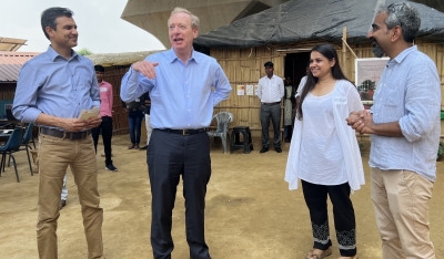

New Delhi– Microsoft President and Vice Chair Brad Smith on Thursday visited SEEDS, a disaster response and preparedness non-profit organisation, which is deploying artificial intelligence (AI) to predict the impact of multiple hazards like cyclones, earthquakes or heat waves in any given area.
In India, that harsher impact is being felt in the nation’s slums, which researchers say can be as much as 6 degree celcius warmer than other parts of the city
“In the slums, it is so difficult to step out and find shade on a hot summer day. It is so congested. The houses are often made of tin sheets, which heat up much faster compared to other materials,” said Anshu Sharma, co-founder of SEEDS.
Since 2017, SEEDS has been working with communities most vulnerable to heat waves, to help people come up with solutions to beat the heat.
Now, with the support of Microsoft’s AI for Humanitarian Action grant, SEEDS has developed an AI model to predict the impact of multiple hazards.
The model, called Sunny Lives, has generated heat wave risk information for around 125,000 people living in slums in New Delhi and Nagpur.
Experts say such intense heat waves are likely to continue. According to a study published in the Weather and Climate Extremes journal last year, India saw more than double the number of heat waves between 2000-2019 than it did between 1980-1999.
The ‘Sunny Lives’ AI model was developed with Microsoft’s AI for Good Lab and supported by a grant from the AI for Humanitarian Action programme.
The risk pipeline that leverages the AI model was co-developed with data science company Gramener and provides a risk map for a particular area.
On the map, each building is color-coded according to its “risk score.”
Built-up density, vegetation, proximity of the building to a water body, roof-type classification: these are some of the key parameters that comprise the matrix that SEEDS uses to calculate the risk score.
The rooftop material, with its attendant heat-absorbing capacity, is a crucial data point: buildings are identified, classified, and mapped based on this capacity.
The risk map can be overlaid onto a regular map available on a smartphone, which makes it handy for volunteers to access when they go out into the field. The maps help them figure out various action points: where they must go to issue warnings, where water scarcity could be an issue, or where the local authorities will need to direct resources.
Over the last couple of years, SEEDS has reached out to 23 slum communities in East Delhi with this approach.
The organisation is now engaging with various state governments in India to extend its model to middle- and high-income group areas. (IANS)